


Thorofare: Day One
I'm posting a little late tonight because I spent my evening playing Ultimate Frisbee. The smoke in the valley from the fires was a little bad, and there was a new fire just across the valley from us, so fresh smoke was filling the air.. It was pretty short lived game, we didn't have too many people show up, but that's ok - I got out and did something anyway.
On with the hike...
 Here's a picture of the pack I hauled around - it was about 55 pounds. Here's a quick run down of stuff that made up the weight: Clothes, ~10 pounds of food, pillow (white roll on top) map, compass, first aid, 2 water bottles (32 oz. each) snacks, harmonica (can't forget that), head net for bugs, rain poncho, flashlight, knife, propane bottle, single burner cooking stove, binoculars, batteries for GPS, the GPS, 2 cameras, sleeping bag (green roll at bottom), tent (that's Rylan's and it's the purple bag at the bottom) lantern, sandals (for crossing water), rope, whistle (never know) P-38 can opener (military issue during WWII - >>check it out<<. Like I said, that's a quick run down, there was more in there, but it's trivial... OH! Don't forget that wonderful hiking staff leaning against the bag!
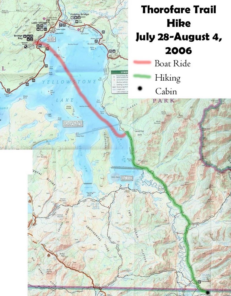
The first map shows our route we took. The red is the boat ride across the lake, and the green is the trail we took on foot. It was 15 miles across the lake and 24 miles on foot. The cabin is the black dot in the lower right hand corner. **Note: You can see any of the maps or pictures in larger versions by clicking on them**
Hiking Map On Sunday morning we woke up around 6:00 and had a quick breakfast before heading to Bridge Bay to catch a boat across Yellowstone Lake at 8:00. The boat ride took about an hour to go 15 miles across the lake, and then we were dropped off and ready to hike by 9:30.
  The trail was relatively flat, considering the lake is at 7,700 feet elevation and the trail gains only 300 feet over 24 miles - that's FLAT! Obviously the trail had more ups and downs than that, but for such elevation it was actually quite nice.
 On Sunday morning we woke up around 6:00 and had a quick breakfast before heading to Bridge Bay to catch a boat across Yellowstone Lake at 8:00. The boat ride took about an hour to go 15 miles across the lake, and then we were dropped off and ready to hike by 9:30.
 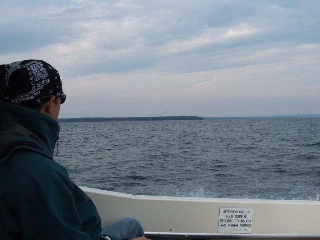 The trail was relatively flat, considering the lake is at 7,700 feet elevation and the trail gains only 300 feet over 24 miles - that's FLAT! Obviously the trail had more ups and downs than that, but for such elevation it was actually quite nice.
 We had to find our trail after getting dropped off, that took nearly an hour to get to, but once we found the trail we picked up the pace just a little.
  We had a quick lunch just a few miles before Beaver Dam Creek and then continued on our way. We had to cross the creek with sandals or water shoes. We stopped there to filter new water with a filtration pump, which helps to reduce 'bad things' getting into the water and eventually into the body.
  The initial crossing was quite easy, but after crossing the river we were confronted with a marsh area which was a little short of a quarter mile long. Wading through the water was a little tough - mainly because the possibility of stepping on a downed log or stick in the water and making a mess of a foot.
 The first day of the hike was mainly through the forest. We came across a few open areas now and then, but this was the part of the park that did not burn during the 1988 fire. We encountered that area farther to the south - where we hiked the second day.
The rest of the day we rather uneventful. We hiked until 7:00 pm - until we finally reached our campsite - and according to the GPS we covered 11.6 miles, but it was a little farther due to the fact that the GPS wasn't tracking our movements through the thick trees. We averages about 1.4 miles/hour. You can see where our camp was for our first night by the blue dot on the map below.
 We had our tents up soon after arriving and had our camp stoves boiling water so we could eat some warm food. After eatting we strung up our food on the bear pole.
  The park service requires/suggests food be hung AT LEAST 10 feet above the ground and 4 feet from any verticle pole or tree... Everyone was pretty tired and we were all tucked away into our sleeping by 9:00 pm - even before the daylight was gone we were all snoozing away and hoping no bears would stop by during the night. Our camp site was heavily used by bears as it was evident from the amount of poo which was everywhere.
  It was a nice meadow area with trees through out it, so I can see why a bear would like it - I liked it myself. Unfortuantly the bears don't seem to understand that we are just passing through and don't want to do anything more than take a picture of them and continue on.
Camp One
 The map above shows our camp - it's kind of hard to see, but like I said, clicking on the pictures allows you to see them in larger versions. You can see the park boundary right at the bottom, that was still 11 miles ahead of us and we had several more river crossings to attempt. Day two tomorrow!
As for me, we are starting work at 7:00 am so I should be finding my way towards bed. It's nearly midnight and here I am all excited to blog about the trip!! ha ha!
Until again
-=Nolan=-
posted by Nolan @ 12:57 AM
![]()
0 Comments:
Post a Comment
<< Home